Nature knows optimization!
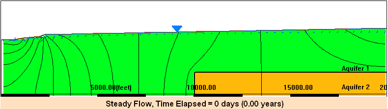
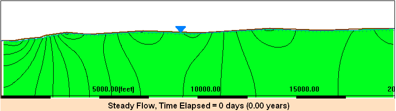
Groundwater flows in the path of least resistance. At each point in it’s journey, it will “select” the next point to go to. So every adjacent point uses the least energy to move to the next point. Modeling groundwater flow is essentially a systematic process to identify and delineate these optimal, least resistance flow paths, connecting recharge points (areas) to discharge points (areas).
A. Watch the videos below and explain the dominant groundwater flow patterns and pathways and how groundwater flows from recharge areas to discharge areas.
B. Develop a MAGNET model that can reproduce the above animations and perform a sensitivity analysis with respect to the following parameters
- hydraulic conductivity in the shallow layer
- hydraulic conductivity in the deep layer
Write a 1 page memo that summarizes the results from your numerical experimentation, pay special attention to what you learn on how deep, invisble geological structure impacts the recharge and discharge relationships at the surface.
MAGNET/Modeling Hints:
- Use ‘Synthetic mode’ in MAGNET to create a model domain.
- To create a 2D vertical profile model in Synthetic mode, use a line feature and the 'Equal to Y (e.g., Water Table)' option to delineate the water table surface toward the top of the model domain.
- After your initial simulation, you can "clean up" the display by then making the space above the water table inactive with a zone feature ( 'Flow Properties' tab > 'Zone Type' > 'Inactive' ).
- Use a relatively large NX (e.g., 100) to resolve the water table shape.